Note: This guide focuses exclusively on the geographical, navigational, and tourism infrastructure of Helen, Georgia, helping visitors seamlessly navigate this alpine-style village in White County.
Navigating the picturesque alpine village of Helen, Georgia requires a solid understanding of its unique layout, regional topography, and local transit networks. Nestled in the Blue Ridge Mountains along the Chattahoochee River, Helen attracts millions of visitors annually for events like Oktoberfest, tubing, and scenic mountain drives. Utilizing an up-to-date Helen GA map ensures efficient travel through the winding mountain passes, historic downtown areas, and surrounding recreational sites without relying solely on fluctuating cellular signals.
Understanding the Topography and Layout of Helen Georgia
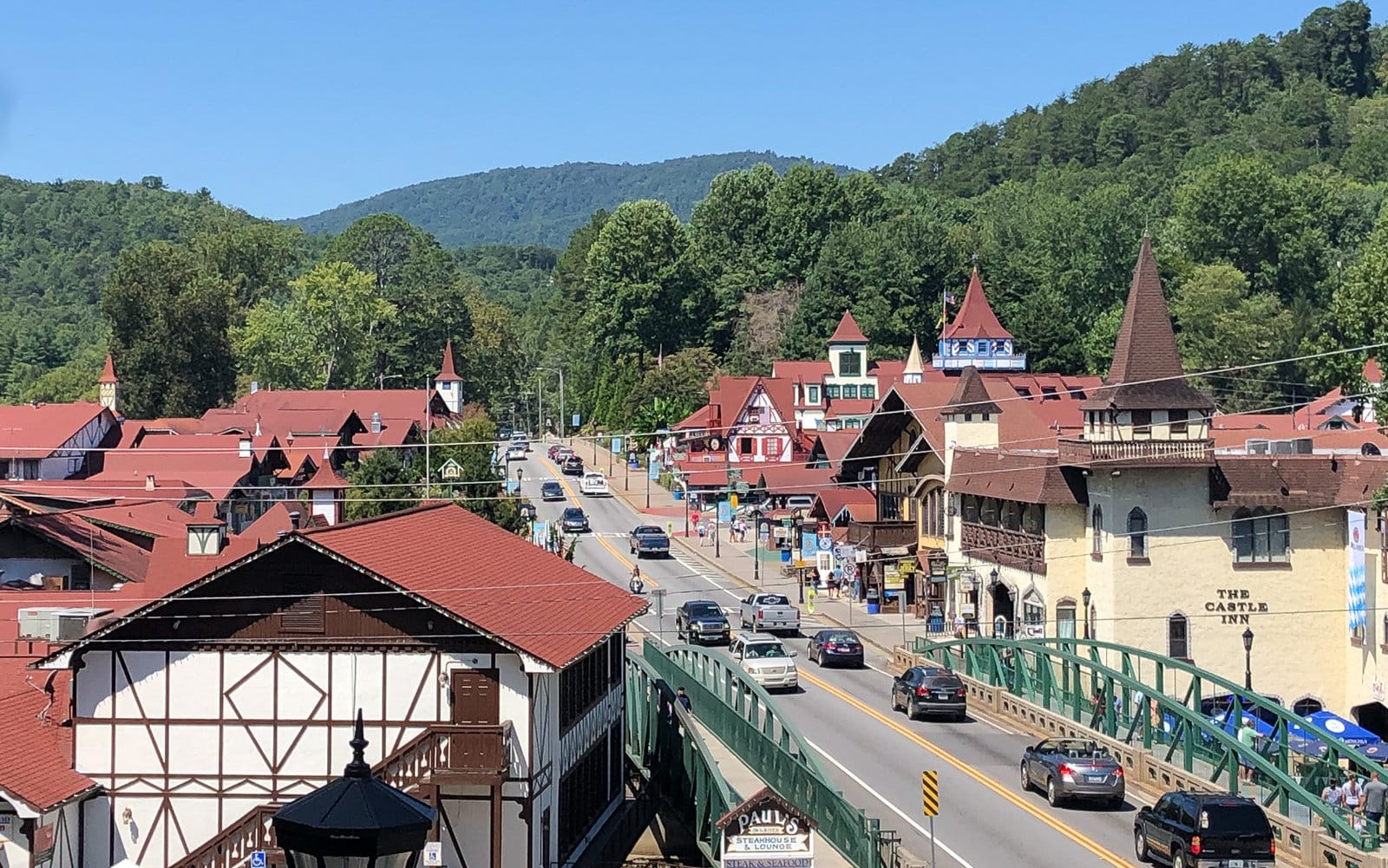
The layout of Helen, Georgia, heavily reflects its Bavarian theme, modeled after a traditional Alpine German village. Main Street (State Route 75) serves as the primary north-south artery cutting directly through the heart of the commercial district. Navigating this corridor requires familiarity with key intersections, pedestrian crossings, and river bridges that connect the east and west sides of the town.
- Main Street (SR 75): The central spine of Helen, housing the majority of Bavarian-style storefronts, restaurants, and gift shops.
- Unicoi Street (SR 358): Branches off Main Street heading east toward Unicoi State Park and Anna Ruby Falls, serving as a vital mountain connector.
- Chattahoochee River Crossings: Multiple bridges link commercial zones, allowing pedestrians and drivers to transition between Alpine Lane, Edelweiss Way, and Main Street.
- Topographic Challenges: Steep elevation gains and winding rural routes surround the valley, making GPS reliance risky without downloaded offline map data.
Essential Geographic Landmarks and Navigation Points
Effective navigation around White County depends on identifying major landmarks that anchor the regional map. Whether you are arriving for a weekend cabin getaway or a day trip, familiarizing yourself with these key coordinates prevents missed turns and wasted fuel on remote forest service roads.
Primary Navigational Waypoints Downtown Helen is densely packed, making walking the preferred method for exploring the village center once parked. Surrounding attractions like Smithgall Woods State Park and the Richard B. Russell Scenic Highway require vehicular transport and careful map tracking due to limited cellular coverage in deep river gorges.
Key Landmarks Table
| Landmark Name | Category | Exact Location / Access Route | Navigational Purpose |
|---|---|---|---|
| Unicoi State Park | Recreation & Lodging | 1788 Highway 358, Helen, GA | Primary hub for hiking, zip-lining, and lake access east of downtown. |
| Anna Ruby Falls | Natural Feature | 3448 Anna Ruby Falls Rd, Helen, GA | Northern destination requiring travel past Unicoi State Park via SR 358. |
| Helen Festhalle | Event Center | 1076 Edelweiss Strasse, Helen, GA | Central venue for Oktoberfest and large gatherings near the river. |
| Smithgall Woods State Park | Conservation Area | 61 Tsalagi Trail, Helen, GA | Southwestern protected area known for trout fishing and trailheads. |
| Chattahoochee River Tubing | Recreation | Multiple access points along Main Street | Water recreation route winding directly through the town center. |
Digital Mapping Tools vs. Traditional Print Maps in the Blue Ridge Mountains
Relying entirely on cloud-based navigation apps can create challenges in the mountainous terrain surrounding Helen. Steep valleys and dense forest canopies frequently disrupt cellular data connections, causing GPS applications to freeze or fail right when a critical turn approaches. Combining digital tools with offline redundancies guarantees reliable travel.
- Offline Google Maps: Download the regional map of White County and North Georgia prior to entering the mountains to maintain turn-by-turn capability without a data signal.
- AllTrails and Topographic Apps: Essential for hikers exploring trails around Yonah Mountain, Raven Cliff Falls, and the Appalachian Trail access points near Helen.
- Official Georgia Department of Transportation (GDOT) Maps: Provide accurate details on seasonal road closures, bridge weight limits, and scenic byway designations.
- Paper Backups: Keeping a physical road map in your vehicle provides an indispensable safety net when digital device batteries fail or signals drop entirely.
Step-by-Step Guide to Navigating Helen GA During Peak Seasons
Visiting Helen during peak tourism windows—such as October for Oktoberfest or mid-summer for tubing—requires strategic route planning. Traffic congestion along Main Street can significantly delay transit times, necessitating alternative routes and parking strategies.
- Arrive Early via State Route 75: Enter Helen from the south via Cleveland, GA, before 9:00 AM during weekends to secure optimal parking near the downtown core.
- Utilize Peripheral Parking Lots: Avoid circling Main Street looking for street parking; instead, target designated municipal and private lots located a short walking distance from the village center.
- Monitor Seasonal Detours: Pay attention to local signage directing traffic away from pedestrian-heavy zones during festivals and holiday weekends.
- Plan Mountain Excursions for Off-Peak Hours: Drive the Richard B. Russell Scenic Highway or visit Anna Ruby Falls early in the morning to avoid vehicular congestion on narrow mountain switchbacks.
- Utilize Offline Navigation Backups: Ensure your mapping application has offline caching enabled for White County and Habersham County sectors before heading into remote trailheads.
Pros and Cons of Various Navigation Strategies in Helen
| Strategy | Advantages | Disadvantages | Best Use Case |
|---|---|---|---|
| Standard GPS Apps (Waze/Google) | Real-time traffic updates, automated rerouting around accidents. | Prone to signal loss in deep mountain gaps and river valleys. | General highway driving outside of remote forest service roads. |
| Downloaded Offline Maps | Zero dependency on cellular data; reliable in remote gorges. | Lacks real-time traffic accident reports and temporary road closures. | Navigating forest service roads, state parks, and mountain gaps. |
| Physical Paper Road Maps | Never runs out of battery; comprehensive regional overview. | Does not show real-time congestion; difficult to read while driving solo. | Emergency backup and macro-level trip planning across North Georgia. |
Frequently Asked Questions About Helen GA Mapping and Travel
How reliable is cell phone service when using a map in Helen GA?
Cellular service is generally reliable within the immediate downtown commercial district of Helen, but coverage drops significantly in surrounding valleys, state parks, and mountain passes. Downloading offline maps before arrival is strongly recommended.
What is the best route to drive from Atlanta to Helen, GA?
The most direct and efficient route is taking Interstate 85 North to Interstate 985 North toward Gainesville, then following State Route 365 and State Route 75 North directly into Helen. This route features well-maintained multi-lane highways for the majority of the trip.
Are RVs and large trailers easy to navigate through downtown Helen?
Navigating large vehicles through downtown Helen can be challenging due to narrow lanes, heavy pedestrian traffic, and tight parking spaces. Drivers of large RVs should utilize peripheral parking areas and avoid tight turns on side streets branching off Main Street.
Where can I find trail maps for hiking around Helen?
Detailed hiking maps are available at the Unicoi State Park visitor center, the Chattahoochee-Oconee National Forest ranger stations, and through digital outdoor navigation platforms like AllTrails or Gaia GPS.
Is parking readily available in downtown Helen during peak festival seasons?
While Helen offers numerous public and private parking lots, they fill up rapidly during October Oktoberfest weekends and autumn leaf-peeping peaks. Arriving before mid-morning is essential to secure convenient parking spaces close to the village center.
Expert Strategic Recommendation for Travelers
To maximize your experience exploring Helen, Georgia, treat map preparation as an essential part of your itinerary rather than an afterthought. Download offline regional maps, map out your primary attractions—such as Unicoi State Park, local wineries, and downtown dining spots—before leaving major metropolitan hubs, and keep a physical road map in your vehicle glove compartment. By combining smart digital preparation with traditional navigational awareness, you will navigate the scenic Blue Ridge Mountains smoothly, safely, and without unnecessary travel delays.